
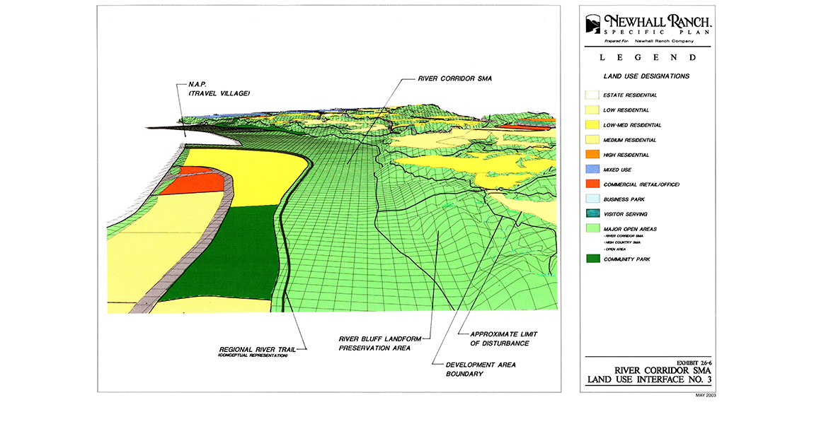
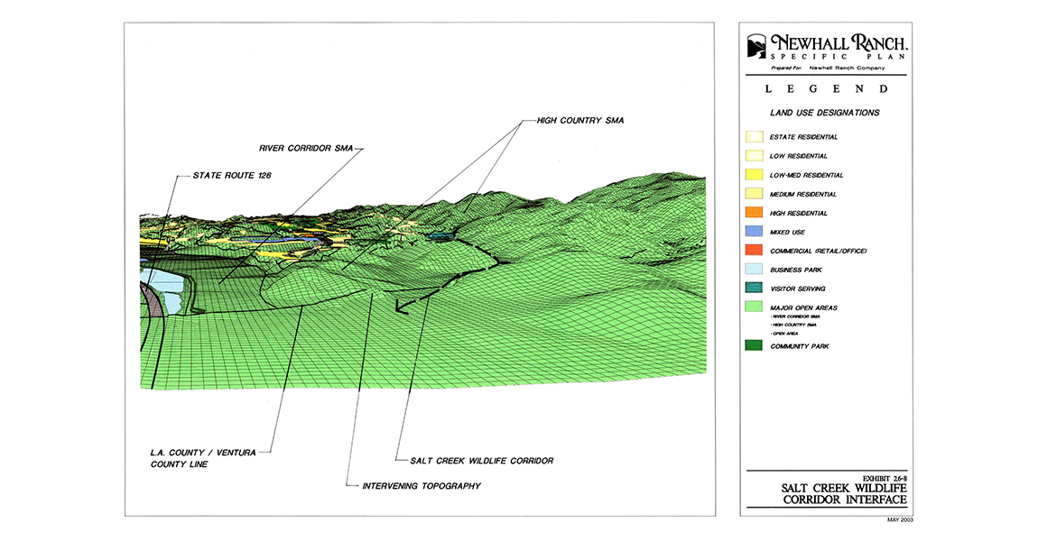
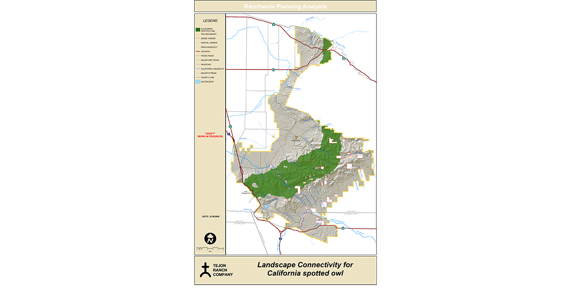
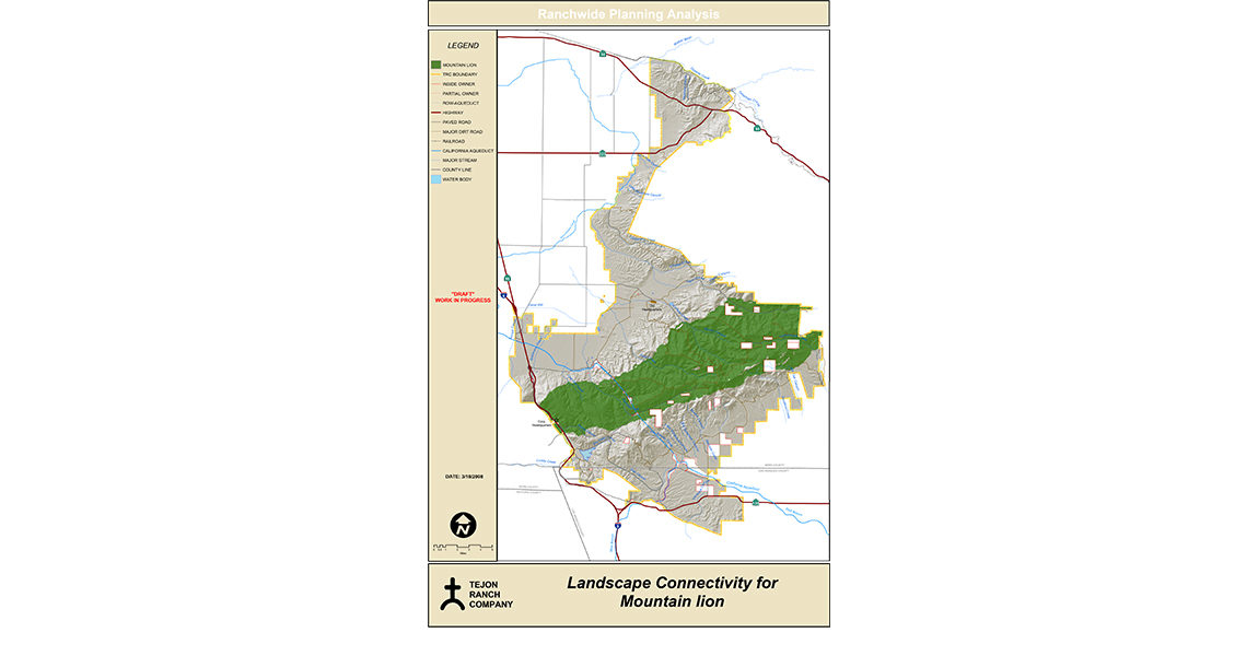
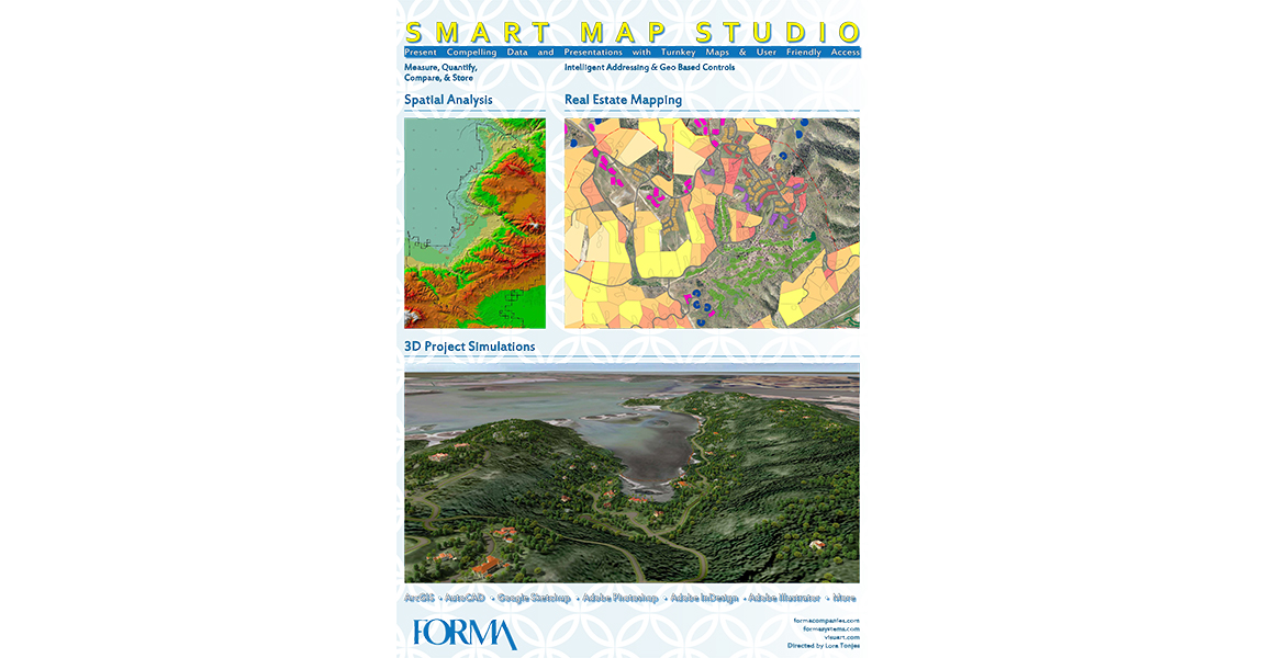
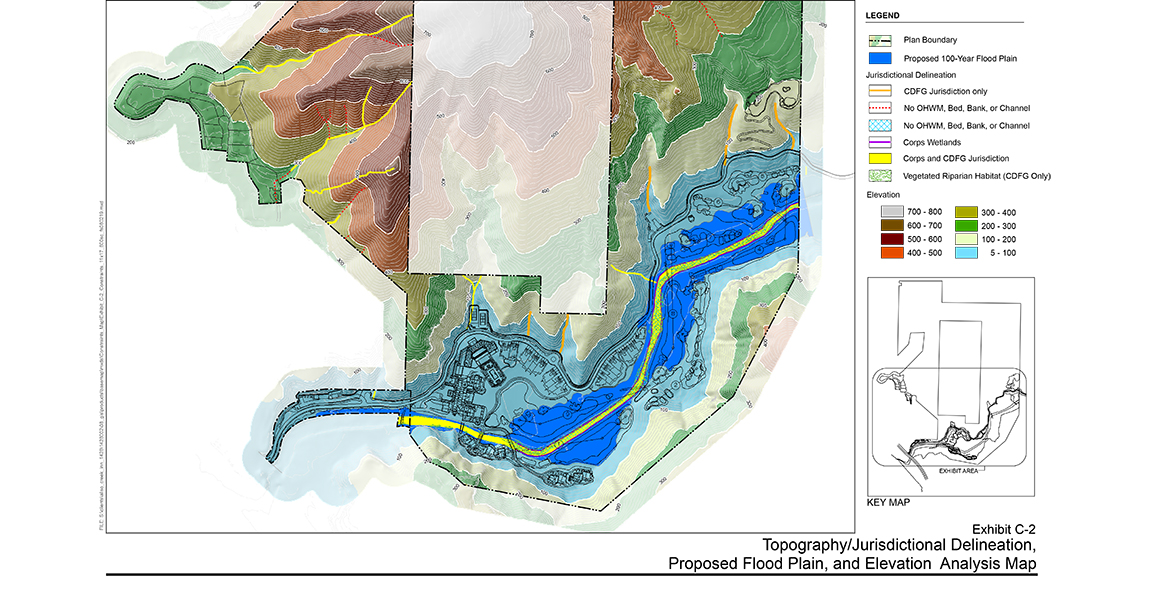
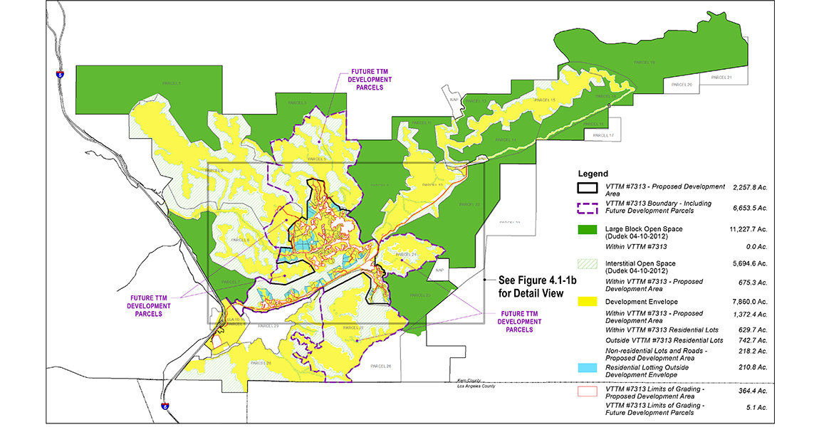
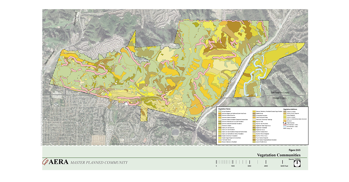
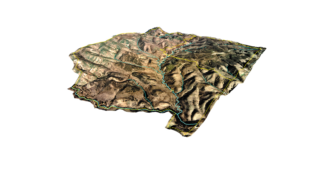
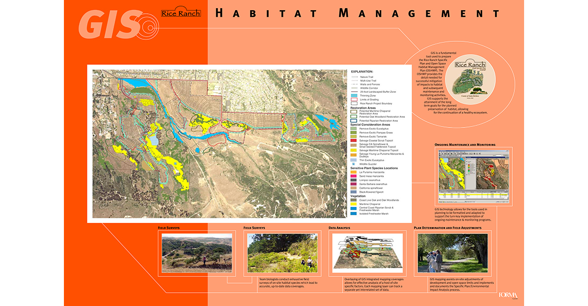
FORMA Systems actively utilizes Geographic Information Systems (GIS) as a tool to support our clients with Internet and desktop application development, database design, Computer-Aided Design (CAD), 3-dimensional modeling, GIS implementation and needs assessment, base map development, and graphic design.
From advanced computer spatial analysis to technical project design, photo-realistic or interactive project simulations, and creative design, we provide our clients with the technology required by today’s industry for effective and implementable project solutions.
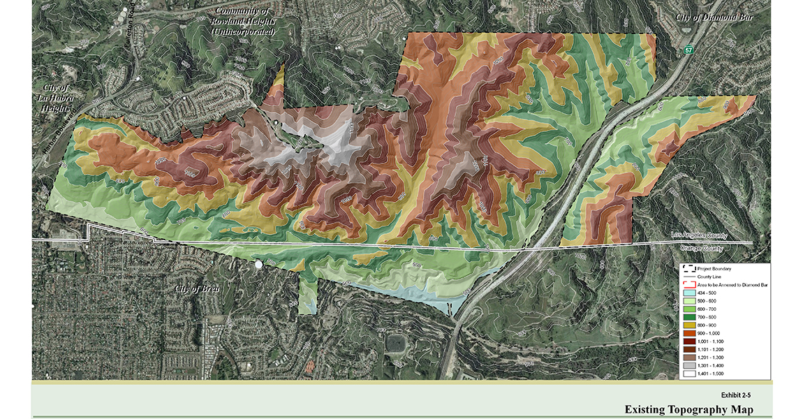
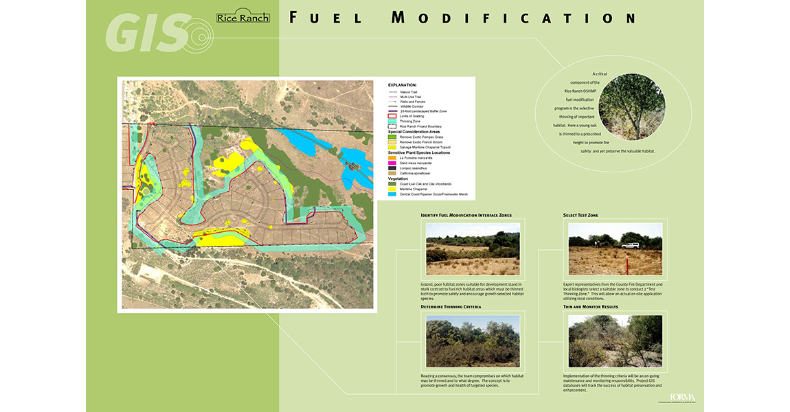